We’d like to remind Forumites to please avoid political debate on the Forum.
This is to keep it a safe and useful space for MoneySaving discussions. Threads that are – or become – political in nature may be removed in line with the Forum’s rules. Thank you for your understanding.
📨 Have you signed up to the Forum's new Email Digest yet? Get a selection of trending threads sent straight to your inbox daily, weekly or monthly!
The Forum now has a brand new text editor, adding a bunch of handy features to use when creating posts. Read more in our how-to guide
Where is London?
Comments
-
Cornucopia wrote: »For my old address, where the Postal Town is 25 miles away, that needs fixing anyway. In those cases, I think "near" nearest town would be more helpful. (In my case, the nearest large town was 9 miles away, so that would have made much more sense than the actual Postal Town chosen by RM).
But that's forgetting how the post gets to you. It doesn't go via that nearest town - it goes via the sorting office in the post town.
And that's all that address says - it's merely RM routing information.0 -
The only meaning it has for you - maybe. But there are social definitions and traditional boundaries that have meanings for many other people - as far as I and many others are concerned, the River Hodder is and always will be the boundary - not anything a council may say. Kentish Men and Maids consider themselves different from Men and Maids of Kent. Psychogeography can trump political geography.Boundaries are purely arbitrary political things, and always have been - the only thing that determines whether you're "in London" or "in Kent" is the political boundary, because that's the only meaning that "in London" or "in Kent" actually has.
You're right (along with others) that Post Town isn't always an accurate geographical guide - but it often ties in with where people feel they belong. My father is from a village which is in Staffordshire but has a Derby postcode. Logical because it's much nearer to Derby than it is to Stafford. Plenty of locals ignore the postcode but are happy to associate with the actual Post Town of Burton-on-Trent .
I haven't looked it up but I'd wager a fiver that the Councils, Postal Boundaries and the BT area codes don't line up either. In fact, I'm certain that 0208 (Outer London) gives way to e.g. 01332 (Dartford) in a different place from the Borough change. There are some who would say it isn't London if it isn't 020 (though they probably used to say it about 01 - then 071 etc.)
Getting back to Motoring - if you aren't totally reliant on satnav and still use road signs; I think it does help to have The North, The South West etc. on motorway signs. Less so to see London 175 miles; if you are needing a break soon then Leicester 16 miles is more helpful.I need to think of something new here...0 -
The only meaning it has for you - maybe.
No, that's the only meaning that there is in the information. No other meaning exists within it, whatever you might want to read into it.But there are social definitions and traditional boundaries that have meanings for many other people - as far as I and many others are concerned, the River Hodder is and always will be the boundary - not anything a council may say. Kentish Men and Maids consider themselves different from Men and Maids of Kent. Psychogeography can trump political geography.
It may be that others ascribe whatever meaning they like to it, but that doesn't mean it's actually present in it. It's merely something they happen to believe, even if it's demonstrably and tangibly wrong.You're right (along with others) that Post Town isn't always an accurate geographical guide - but it often ties in with where people feel they belong. My father is from a village which is in Staffordshire but has a Derby postcode. Logical because it's much nearer to Derby than it is to Stafford. Plenty of locals ignore the postcode but are happy to associate with the actual Post Town of Burton-on-Trent .
And Sheffield postcodes extend well into Derbyshire. So? None of where people "think they associate with" has anything whatsoever to do with how their post reaches them, which is all that the postcode says.I haven't looked it up but I'd wager a fiver that the Councils, Postal Boundaries and the BT area codes don't line up either.
Of course they don't. Why would they?In fact, I'm certain that 0208 (Outer London) gives way to e.g. 01332 (Dartford) in a different place from the Borough change. There are some who would say it isn't London if it isn't 020 (though they probably used to say it about 01 - then 071 etc.)
Umm, yes. Quite.
Phone numbers don't say anything about anything but just which exchange the other end of your phone line is tied to.
And "all London" is 020.
01 was "all London".
071/081 were "inner/outer".
0171/0181 were "inner/outer".
020 is "all London". 7 and 8 are not the only digits that 020 phone numbers start with any more, and they're not geographically assigned in any way within 020.
But "all London" does not mean "all phone numbers in London". 01895, Uxbridge, covers most of the London Borough of Hillingdon. There are other codes all the way around the edge of London.0 -
No, that's the only meaning that there is in the information. No other meaning exists within it, whatever you might want to read into it.
The upshot of which is that the address as controlled by Royal Mail is the only officially-sanctioned identifier of where each of us live, but its actual meaning is limited and in some cases misleading.
Having looked at the postcode map of Kent, I can make some sense of it, now.
The TN postcode area is massive - and it's "home" in Tonbridge is at one end of it. The other end, Ashford, is probably larger and more important than Tonbridge, but it has a TN postcode.
There are many Postal Towns within the TN area, and the choice of which small towns should be Postal Towns seems quite arbitrary.
Where I used to live was near the border of the ME & TN postcodes, and I was nearer to Maidstone, which is a Postal Town, but it is in the ME area, not TN, so therefore it could not be my Postal Town, and because my town was apparently not big enough to be a Postal Town, I ended up with Tonbridge, 25 miles away.
I cannot remember what happened with missed parcel deliveries, but delivery vans were often problematic.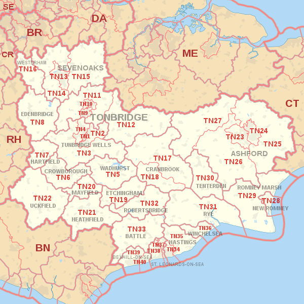 0
0 -
Cornucopia wrote: »The upshot of which is that the address as controlled by Royal Mail is the only officially-sanctioned identifier of where each of us live
For postal purposes, sure. That's the only meaning that the Royal Mail "official" address has.
Your local council use it - because they post things to you. But theirs is the definition that counts, when it comes to what local politicians you get to vote for, who you pay your council tax to, and who empties your bins.
Your phone provider use it - because they post things to you. But theirs is the definition that counts, when it comes to what somebody taps into their phone to make your phone ring.
Couriers use it - because who needs to remember a separate "address" for each courier firm that might deliver something? One single address, and it doesn't matter who delivers it.
What you think of as your local/regional identity or allegiance...? Well, that's your own decision. No more, no less.
We've got friends who live in the same village as us who pay completely different council tax, get to vote for completely different candidates in completely different elections, get their bins emptied by a different wagon on a different day - but have the same basic postcode and whose phone number is only a couple of digits different, because it hangs off the exact same exchange as ours.0 -
Of course it makes sense to use a consistent postal address for things that are posted, and who better to determine that than the Royal Mail?
The issue is that that is not necessarily a good data match for the physical location. Which is where the issue with other users of the data come in. For couriers, it was a problem. Hopefully not any more with the advent of satnav.
It'd be interesting to know what other users of the data do when they need to access real, physical locations. The utility companies, for example. Presumably they don't work from, say, TN16 to TN17 (which are miles apart) just because they are numerically next to each other. So they must have that huge database that translates postcodes to physical locations. (I had a hunch someone must do).0 -
Cornucopia wrote: »Of course it makes sense to use a consistent postal address for things that are posted, and who better to determine that than the Royal Mail?
The issue is that that is not necessarily a good data match for the physical location. Which is where the issue with other users of the data come in. For couriers, it was a problem. Hopefully not any more with the advent of satnav.
It'd be interesting to know what other users of the data do when they need to access real, physical locations. The utility companies, for example. Presumably they don't work from, say, TN16 to TN17 (which are miles apart) just because they are numerically next to each other. So they must have that huge database that translates postcodes to physical locations. (I had a hunch someone must do).
That database is available to anyone from Royal Mail - for a price - and is updated regularly.
The data consists of a single OS reference for each postcode, which corresponds to the first delivery address within that postcode.
It is very precise (1 metre) for that one address, but probably of little use for utility providers.0 -
Back to the OP's question - in a very good article on London road signs on the LondonReconnections website , the exact answer appears. It is Charing Cross - just not quite the Charing Cross that springs to mind, and explains the earlier post by Scooler that Google maps directions says "London" is 72ft from "Charing Cross"
The quotation from the LR article :
"As new signs were to be installed all over London, and distances would have to be calculated for them all, the opportunity was taken to correct a quirk of history. Until 1951, London did not have a central point to which distances were measured. Traditionally, there were actually seven such places, all related to the itineraries of mail coaches in centuries gone by. They were incredibly inconsistent, and only one was within a mile of Charing Cross. Depending on the direction of approach, distances might be measured from Marble Arch, Hyde Park Corner, Westminster Bridge, London Bridge, Whitechapel Church, Shoreditch Church or (perhaps the most obscure of all) the site of Hick’s Hall on St John Street, a building that had been demolished in 1778.
It might be expected that a rational decision to choose just one point would be welcomed, but in fact press coverage was decidedly mixed and there appeared to be some considerable affection for the old system. Nonetheless a new datum point was chosen – the statue of Charles I on the south side of Trafalgar Square, the original site of the Charing Cross. Indeed Westminster Council put a plaque on the site, still there today, which marks the significance of King Charles’ feet.
All mileages on the new signs – and indeed on all road signs erected in the capital since that time – have measured their distance to London from this point.
The Ministry didn’t elaborate on its reasons for selecting the statue on Trafalgar Square, but until that time it appears to have only been significant for one reason. In 1831, the London Hackney Carriage Act selected the statue as the centre point of the six-mile radius that defines The Knowledge. Motorists nationwide now count their distance from London with reference to Charing Cross, seemingly because that’s where London’s cab drivers consider the centre of the metropolis to be. Perhaps it was thought that there was no higher authority on the subject."0 -
So, JP08 has nicely covered the original question.
On the Kent / London question: I grew up in London Borough of Bexley, at a DA post, and we used to quote our address as "Bexley, Kent" with no mention of Dartford or London. But that was 25 years ago, so who knows if that was right then or now? I am sure there any plenty of Bexley inhabitants who like to think of themselves living in Kent, whatever the postal or political boundaries.
What about the other interesting question raised up-thread: where is the road mileage sign furthest from London that lists London as a destination?0 -
FormulaDriven wrote: »What about the other interesting question raised up-thread: where is the road mileage sign furthest from London that lists London as a destination?
Just to get you started, using Google streetview, I found a sign on the A1(M) just south of Peterborough with London 77. I am sure that can be easily beaten...0


This discussion has been closed.
Confirm your email address to Create Threads and Reply

Categories
- All Categories
- 354.1K Banking & Borrowing
- 254.3K Reduce Debt & Boost Income
- 455.3K Spending & Discounts
- 247.1K Work, Benefits & Business
- 603.7K Mortgages, Homes & Bills
- 178.3K Life & Family
- 261.2K Travel & Transport
- 1.5M Hobbies & Leisure
- 16.1K Discuss & Feedback
- 37.7K Read-Only Boards