We’d like to remind Forumites to please avoid political debate on the Forum.
This is to keep it a safe and useful space for MoneySaving discussions. Threads that are – or become – political in nature may be removed in line with the Forum’s rules. Thank you for your understanding.
PLEASE READ BEFORE POSTING: Hello Forumites! In order to help keep the Forum a useful, safe and friendly place for our users, discussions around non-MoneySaving matters are not permitted per the Forum rules. While we understand that mentioning house prices may sometimes be relevant to a user's specific MoneySaving situation, we ask that you please avoid veering into broad, general debates about the market, the economy and politics, as these can unfortunately lead to abusive or hateful behaviour. Threads that are found to have derailed into wider discussions may be removed. Users who repeatedly disregard this may have their Forum account banned. Please also avoid posting personally identifiable information, including links to your own online property listing which may reveal your address. Thank you for your understanding.
📨 Have you signed up to the Forum's new Email Digest yet? Get a selection of trending threads sent straight to your inbox daily, weekly or monthly!
The Forum now has a brand new text editor, adding a bunch of handy features to use when creating posts. Read more in our how-to guide
Extending house
Comments
-
No there is no key- I’ll have a dig around in the paperwork I had when I bought the house. I kept everything so i’ll see if it says anything about it
0 -
ProDave said:
What was the title and "use" of the map? Does it have a key showing what the different coloured shadings mean, in particular the white shadings that we are taking to mean the extent of the gardens?RebeccaCar said:ProDave said:It looks like standard Mastermap® colouring relating to the surface type - i.e. salmon for structures, green for 'natural', greys for roads and paths, and pale yellow indicating "multiple surface" (e.g. typical domestic gardens).I don't think there is any 'legal' significance in the plan.Furthermore, the OP is aware from the conveyancing process that this strip of land is not included within their title (AIUI). The OS mapping won't change that, the only significant question is whether the land has Highway status or not, and that isnt shown on standard Mastermap®.0 -
After initially reading the map upside down! I have the dreaded pink showing a Highway!0
-
Niv said:
I drew a line from your back boundary line and it appears to follow the line of the house, anyone think there could be anything in this? Or could this just a complete coincidence?
It probably adds no weight either way , but thought it worth pointing out.Not definitive, but if looking for clues on the OS plan I'd suggest the following might be relevant factors - 1) Projecting the boundary of the property to the rear more or less coincides with the alignment of the flank wall of the OP's house. (purple line)2) The footway 'wraps round' the junction mouth and ends at the flank wall of the OP's garage(?) (orange circle). If the boundary was where the brick wall is then you'd expect the footway to end there, with a crossing point at that position (typical detail for an estate of this era)3) The distances marked with cyan/blue arrows are all roughly equal - if the OP's driveway was verge then there would be approximate symmetry between the four grassed areas. This 'village green' layout is also typical of development in this era.Just my guesswork from experience though.1
 -
The only difference i see here is that the boundary you refer to isn't solid fully like other properties, there is one section that is dotted lined rather than solid so i wonder if that has some meaning.ProDave said:
The white area that appears to show your garden area appears to include the disputed driveway.RebeccaCar said: The shelter word is a bus stop. The grey is all public roads
The green (grass verge) between the footpath and your wall probably is classed as "highway" I researched this a bit when buying a building plot, and the law appears to be an unfenced area adjacent to a highway my be classed as highway up to 3 metres from the edge of the highway. It might be worth measuring that grass verge, if more than 3 metres (at the point you are planning the extension) there would be little fear of anyone claiming your drive is "highway" In any event the wording is unfenced land adjacent to the highway. You have a great big brick wall that would stop any claim of your drive being highway.
Where did that map come from? Was it the land registry, that is the map you want to be looking at if it was not the land registry.
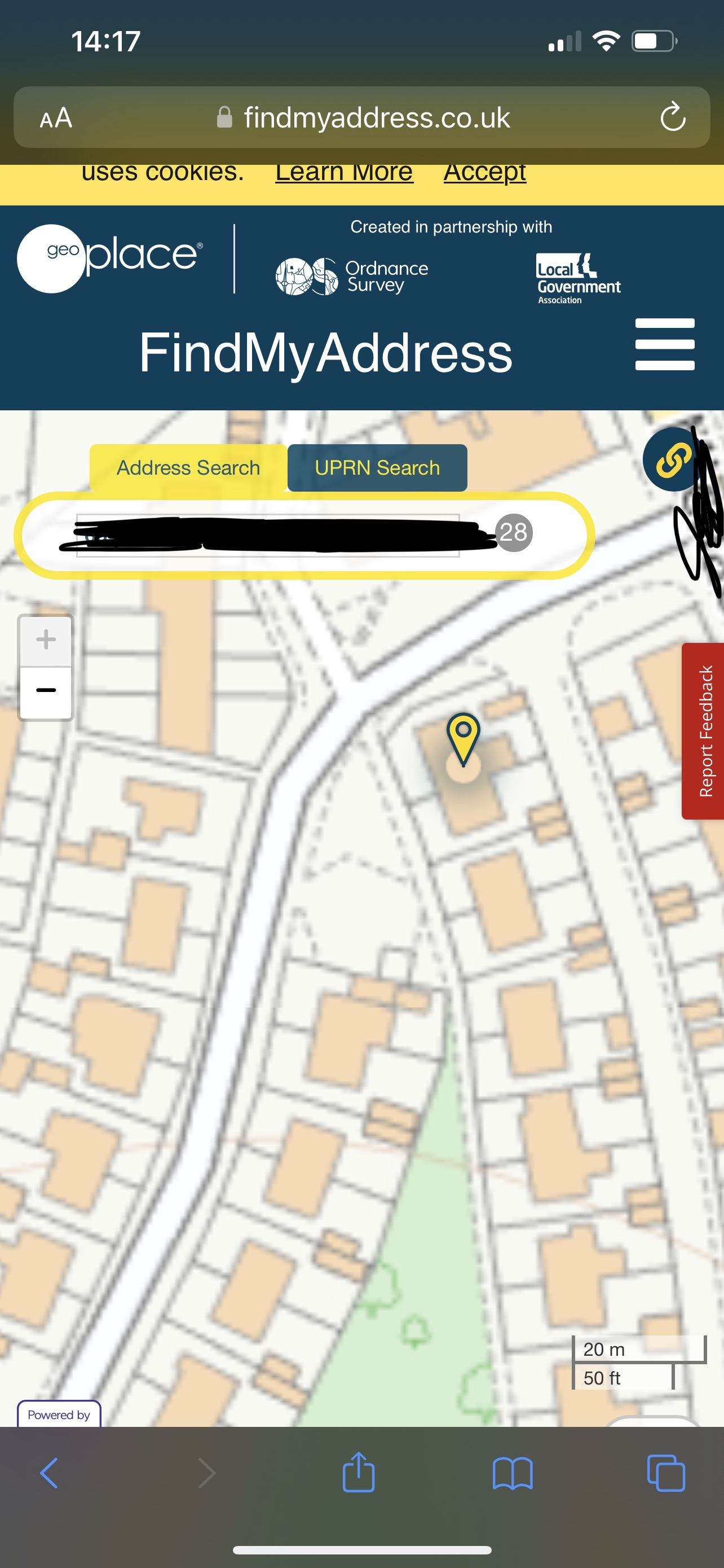
Another useful mapping site is this one: https://www.findmyaddress.co.uk/search
Agree to the T&C and pop your address in the search bar and post a screen grab (suitably anonymised) of what it shows.0 -
Hope this is ok
 0
0 -
Thanks all for your time in posting advice. I think I’ll make an appointment with a solicitor on Monday.One question though- does the white section immediately around my house mean that the highway restrictions won’t apply as much? Or is that wishful thinking! 🙈0
-
The fact the driveway (which i don't think it was ever supposed to be a driveway) is not owned by you means its owned by someone else, the fact that it was not sold as part of the property indicates that it is council owned or more likely part of the highway.RebeccaCar said:Thanks all for your time in posting advice. I think I’ll make an appointment with a solicitor on Monday.One question though- does the white section immediately around my house mean that the highway restrictions won’t apply as much? Or is that wishful thinking! 🙈
It looks like the previous owner has made it a drive without permission, this could open up a bag of worms for you in the long run.0 -
Hopefully permission of some sort was given as the council approved it. I get that owning the land in some way might prove to be difficult. I’m seeking some legal advice next week but I’m a whole lot clearer on what the potential issues are thanks to everyone here that has commented. Appreciate it :-)0
-
RebeccaCar said:One question though- does the white section immediately around my house mean that the highway restrictions won’t apply as much? Or is that wishful thinking!Wishful thinking probably. I don't think too much can be read into either the OS or the highway plans. The OS plan colouring is simply what the cartographer 'sees' when creating the dataset. The highway plan is inconsistent in the way areas are shaded pink or left white. The fact the car park and other grassed areas are shaded pink would tend to suggest these areas of the estate generally have been transferred to highways rather than being retained by housing. Looking at this plan alone, there is no logical reason why the grass verge next to yours (and also next to the property behind) wouldn't be highway if they are still in council ownership.Looking more closely at the plan, I asked earlier whether there was an electricity substation nearby which might be why this land was there (i.e. providing a route for HV cables). I think it likely the small square area in the corner of the car park is probably where the substation is. Before getting too advanced with your plans you should find out whether there are electricity cables in the verge and/or under your drive - you won't be allowed to build over (or close to) HV cables, and having them moved is likely to be prohibitively expensive.Also, comparing the size of your semi-pair to the others in the street, has yours already had a side extension? If so, you might find it harder than normal to get planning consent for an additional side extension, as councils tend to resist this because of the 'terracing effect'. And if the property already has (say) four bedrooms then it may be more likely the council will require at least three off-street parking spaces provided within your property boundary, depending on local policy.In other words, I wouldn't invest to much time and money into your plans without getting some of these big items ticked off - the land ownership question is one of those.0


Confirm your email address to Create Threads and Reply

Categories
- All Categories
- 354.6K Banking & Borrowing
- 254.5K Reduce Debt & Boost Income
- 455.5K Spending & Discounts
- 247.5K Work, Benefits & Business
- 604.4K Mortgages, Homes & Bills
- 178.6K Life & Family
- 262K Travel & Transport
- 1.5M Hobbies & Leisure
- 16.1K Discuss & Feedback
- 37.7K Read-Only Boards