We'd like to remind Forumites to please avoid political debate on the Forum... Read More »
PLEASE READ BEFORE POSTING: Hello Forumites! In order to help keep the Forum a useful, safe and friendly place for our users, discussions around non-MoneySaving matters are not permitted per the Forum rules. While we understand that mentioning house prices may sometimes be relevant to a user's specific MoneySaving situation, we ask that you please avoid veering into broad, general debates about the market, the economy and politics, as these can unfortunately lead to abusive or hateful behaviour. Threads that are found to have derailed into wider discussions may be removed. Users who repeatedly disregard this may have their Forum account banned. Please also avoid posting personally identifiable information, including links to your own online property listing which may reveal your address. Thank you for your understanding.
📨 Have you signed up to the Forum's new Email Digest yet? Get a selection of trending threads sent straight to your inbox daily, weekly or monthly!
Land survey report shows moderate-high ground stability risk, how concerned should I be?
Comments
-
I'd be more concerned if the infill was under the property itself.
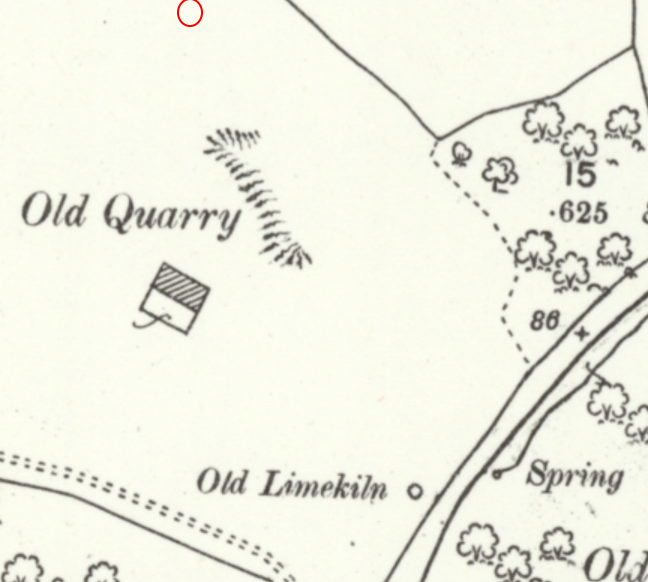
Have you checked local news etc for chat about any problems relating to this sort of thing? There was a former quarry near an old home of mine which blighted a whole street.0 -
I thought you were very fast off the mark with the various versions of the old maps! It took me much longer to get to grips with the options.NibblyPig said:Thanks for the replies. The map site linked above, I went to the location and clicked through all of the historic maps, none of them had any useful data on them, but I just went again and found that I had the wrong thing selected lol so this is the extent of what I could find, all the other maps were either too zoomed out or had nothing labelled.1888-1913I drew the red circle myself roughly where the house is.1892-1914 1949-1972Not really sure where to go from here then. Any thoughts?I'd say the limestone quarry is one of the better results you might get. Quarrying stone to burn with coal to make lime was a common practice and didn't usually involve tunnelling in the way coal mining did in the areas where I've lived.Like surveyors, writers of reports like these want to cover all bases and there's a danger of interpreting them in too pessimistic a manner. Personally, from what I can see, I'd not be worried, but others may hold another view.1
Confirm your email address to Create Threads and Reply

Categories
- All Categories
- 351.6K Banking & Borrowing
- 253.3K Reduce Debt & Boost Income
- 453.9K Spending & Discounts
- 244.6K Work, Benefits & Business
- 599.9K Mortgages, Homes & Bills
- 177.2K Life & Family
- 258.2K Travel & Transport
- 1.5M Hobbies & Leisure
- 16.2K Discuss & Feedback
- 37.6K Read-Only Boards


